How to Reach Manipur
Planning to Visit Manipur? Find the various ways to travel to Manipur by Road, Cars, Trains, Indian
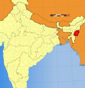
Location of Manipur
Manipur is located in the northeastern part India and share borders with Nagaland to the north, Mizoram to the south and Assam to the west; it also borders Burma to the east. It also falls under the Southeast Asia region.
Getting here – How to Reach Manipur
Railways, Flights, Airlines and Airports in Manipur.
By Air:
Tulihal Airport in Changangei, Imphal is the only airport of Manipur which is connected directly with Delhi, Kolkata, Guwahati and Agartala.
By Train:
There are no direct train service to Sikkim. The railway stations at Dimapur in Nagaland at a distance of 215 km from Imphal. National Highway 53 (India) connects Manipur with another railway station at Silchar in Assam, which is 269 km away from Imphal.
By Road:
National Highway NH-39 links Manipur with the rest of the country, Manipur State Road Transport Corporation(MSRTC) and many other private buses available to reach various parts of Manipur and nearby states.
If you have any suggestions, feedback regarding How to reach Manipur/ road information, Manipur flight, airlines information, which train to catch to reach Manipur or You want to add/remove any particular information on this “How to reach Manipur page” then please email us at: support(at)traveldealsfinder(dot)com (Do mention the URL of page for which you are making any suggestions).
Note: All the Manipur map images/ Videos of Manipur belong to their respective owners. We have used Manipur images & videos for information purpose only. If you are the owner & want to remove that image/video then do write us at mentioned email. Information on Flights, Rails, Road distance to Manipur may be differ from actual so we request you to check Indian Railways, Airlines and other related Manipur tourism department Govt website of for latest updates.