How to Reach Maharashtra
Planning to Visit Maharashtra ? Find the various ways to travel to Maharashtra by Road, Cars, Trains, Indian Railways, Flights, Airlines and Airports in Maharashtra.
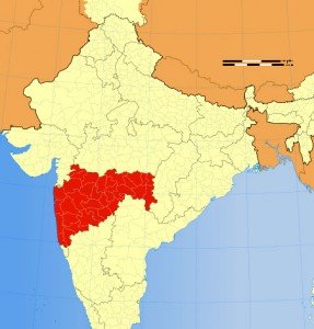
Location of Maharashtra
Maharashtra is located in the western part of India and is share its borders with Arabian Sea to the west, Gujarat and the Union territory of Dadra and Nagar Haveli to the northwest, Madhya Pradesh to the northeast, Chhattisgarh to the east, Karnataka to the south, Andhra Pradesh to the southeast, and Goa to the southwest. Maharashtra stretches from the west coast to the interior regions and its climate too varies with its geography.
Getting here – How to Reach Maharashtra
By Air (Flights):
Maharashtra has three international airports: Mumbai Chhatrapati Shivaji International Airport, Pune civil enclave international airport with flights to Dubai and Frankfurt, Nagpur Dr. Babasaheb Ambedkar International Airport.
The other domestic airports are at Aurangabad and Nanded, are served by scheduled domestic services. Additionally, there are smaller airports like those at Akola, Amravati, Baramati, Chandrapur, Dhule, Gondia, Jalgaon, Karad, Kolhapur, Latur, Nashik, Osmanabad, Ratnagiri, Solapur and Yavatmal that do not have any scheduled air services.
By train:
Maharastra is well connected with other parts of India by the Indian Railways. Mumbai is the headquarters of the Central and Western railways while Nagpur, which is close to the geographical centre of India has rail connectivity with all the metro cities of India.
- The Central Railway and the Western Railway zones of the Indian Railways that are headquartered in Mumbai, at Chhatrapati Shivaji Terminus and Churchgate respectively
- The Nanded division of the South Central Railway that caters to the Marathwada region of Maharashtra
- The Konkan Railway, a subsidiary of the Indian Railways based in CBD Belapur, Navi Mumbai that serves the Konkan coastal region south of Mumbai and continues down the west coast of India.
By Road:
Maharashtra has the largest road network in India with 17 National Highways which connect Maharashtra to six neighbouring states. The Maharashtra State Road Transport Corporation (MSRTC) has been providing passenger road transport service in the public sector since 1948, linking most of the towns and villages in and around the state. There are many privately run luxury buses which ply between major towns. Other modes of public transport, such as a seven-seater tempo have gained popularity in semi-urban areas.
If you have any suggestions, feedback regarding How to reach Maharashtra/ road information, Maharashtra flight, airlines information, which train to catch to reach Maharashtra or You want to add/remove any particular information on this “How to reach Maharashtra page” then please email us at: support(at)traveldealsfinder(dot)com (Do mention the URL of page for which you are making any suggestions).
Note: All the Maharashtra map images/ Videos of Maharashtra belong to their respective owners. We have used Maharashtra images & videos for information purpose only. If you are the owner & want to remove that image/video then do write us at mentioned email. Information on Flights, Rails, Road distance to Maharashtra may be differ from actual so we request you to check Indian Railways, Airlines and other related Maharashtra tourism department Govt website of for latest updates.